BSH Commissions Fraunhofer IWES to Conduct Preliminary Assessment of Soil Conditions
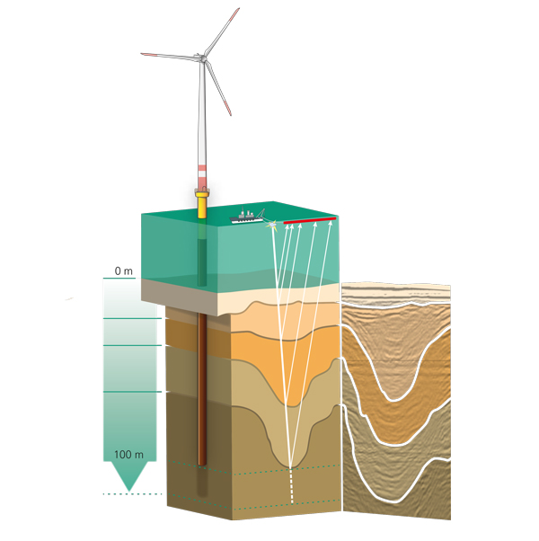
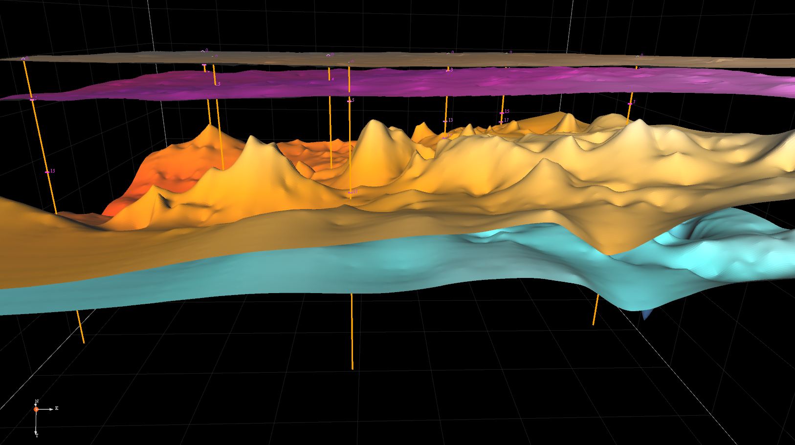
In accordance with the German Offshore Wind Energy Act (WindSeeG), preliminary assessment of soil conditions must be performed before contracts can be awarded for new offshore wind farm clusters in the North and Baltic Sea. Important information relating to the marine environment, the subsoil, and the wind and oceanographic conditions allow bidders to assess the construction costs and expected return more accurately. The German Federal Maritime and Hydrographic Agency (BSH) has selected Fraunhofer IWES, among others, to conduct initial exploratory work for the first bidding round. Researchers will compile 3D seabed models based on geophysical data. The so-called multichannel seismic survey method delivers high-resolution data for soil layers at all relevant depths for wind turbine fundaments. The measurement campaign to collect the data is planned for September.
Knowledge of the soil conditions is all-important when planning and developing offshore wind parks: This information can be used as a basis when selecting and sizing the support structures for wind turbines. Since foundation works make up a large share of the overall costs in wind farm development, a realistic estimate of this expenditure plays a major role in determining the project’s economic viability. In 2017, the WindSeeG specified that the BSH must employ a tendering procedure for the awarding of exploratory work. Fraunhofer IWES, among others, was chosen in the first tender round. “We are delighted to have been selected and to have this opportunity to employ our multichannel seismic survey method for the BSH,” explained Dr. Bernhard Lange, Division Manager Wind Farm Planning and Operation at Fraunhofer IWES.
The system has already been successfully used for geophysical surveys at several German wind farms and in various research projects in both the North and Baltic Seas. A method such as multichannel seismic measuring in combination with isolated findings from geological drilling and cone penetration tests makes it possible to create an extensive overall picture of the seabed. As such, this results in valuable information for the foundations of wind turbines. The method also offers numerous advantages for the re-dimensioning of planned wind parks: If, for example, a larger MW class is selected, which results in fewer turbines at changed positions, this can in some cases be implemented without follow-up surveys if high-quality and extensive data were collected at the start of the planning work. The Fraunhofer IWES methodology has been optimized for use in water depths of less than 100 meters. The signal characteristics combined with a digital, highly sensitive multichannel registration unit (streamer) ensure the penetration of the acoustic signal to the intended foundation depth of the wind turbines and its reception.
The geophysical survey of the site is scheduled for September. Depending on the size of the area to be surveyed, the measurement campaign may take up to several weeks. During the campaign, acoustic signals are transmitted under water and the reflected acoustic waves are received and recorded using hydrophones. These reflections allow identification of the nature of the soil layers over several kilometers and provide information on the substances that will be encountered there. This, in turn, makes it easier to determine the technical factors which could affect the stability of a wind turbine or of a converter platform weighing up to 20,000 t. This information is published within the scope of the bidding process for the areas by the German Federal Network Agency (BNetzA).

